Triglav 125000
Julian Alps - Slovenia
£9.99
Temp Out Of Stock
| Cordee Code: | CMY127 |
|---|---|
| Page Size: | 125 x 220 mm |
| Publisher: | Sidarta D.o.o. |
| ISBN13: | 3830008646330 |
| Scale: | 1:25,000 |
| Published Date: | August 2013 |
| Binding: | Sheet Map (folded) |
| Weight: | 100g |
| Product Type: | simple |
| Countries: | Slovenia |
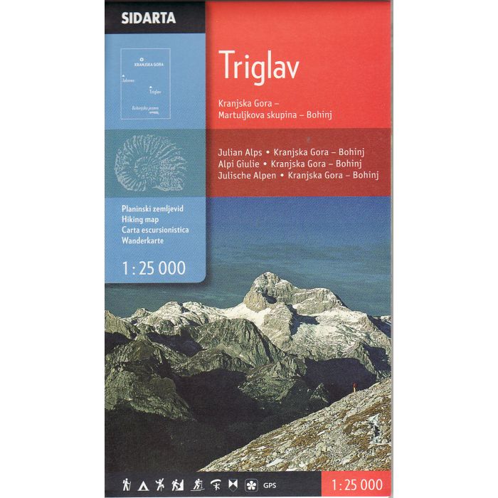
This map covers the central area of the Julian Alps. Western most peak on the map is Jalovec, in the north of Pec (Ofen), the eastern edge of the map is-Mojstrana Boh. Bistrica, is the southern edge.
At the edge of the map is a list of mountain huts, with contact details, opening hours, sleeping facilities and accessibility. Schematically shows the distances between huts and walking distance to the major peaks of the individual cottages.
At the edge of the map is a list of mountain huts, with contact details, opening hours, sleeping facilities and accessibility. Schematically shows the distances between huts and walking distance to the major peaks of the individual cottages.
-
 Slovenia in Your HandsAll you need to know for visiting Slovenia in one guide£14.99
CTA821
In Stock -
-