Stourport Ring Droitwich Ring Laminated
incl town plans of Droitwich Spa, Worcester & Kidderminster
£12.50
In Stock
Usually dispatched within 24 hrs. Free delivery to UK for orders £25 and over
A full colour map of the Stourport and Droitwich Rings suitable for both waterways and leisure users.
This map gives detailed coverage of the Stourport and Droitwich Rings including the whole of the Staffordshire and Worcestershire Canal up to Great Haywood Junction where it joins the Trent and Mersey Canal, with emphasis on the waterways and information useful and relevant to users of the waterways without neglecting other leisure users. The map detail is complimented by information panels and photographs.
This map gives detailed coverage of the Stourport and Droitwich Rings including the whole of the Staffordshire and Worcestershire Canal up to Great Haywood Junction where it joins the Trent and Mersey Canal, with emphasis on the waterways and information useful and relevant to users of the waterways without neglecting other leisure users. The map detail is complimented by information panels and photographs.
| Cordee Code: | CTK689 |
|---|---|
| Page Size: | 136 x 210 mm |
| No of Pages: | 2 |
| Publisher: | Map Laminators |
| Scale: | 1:55,000 |
| Published Date: | February 2016 |
| Binding: | Waterproof Map (folded) |
| Weight: | 100g |
| Product Type: | simple |
| Countries: | United Kingdom |
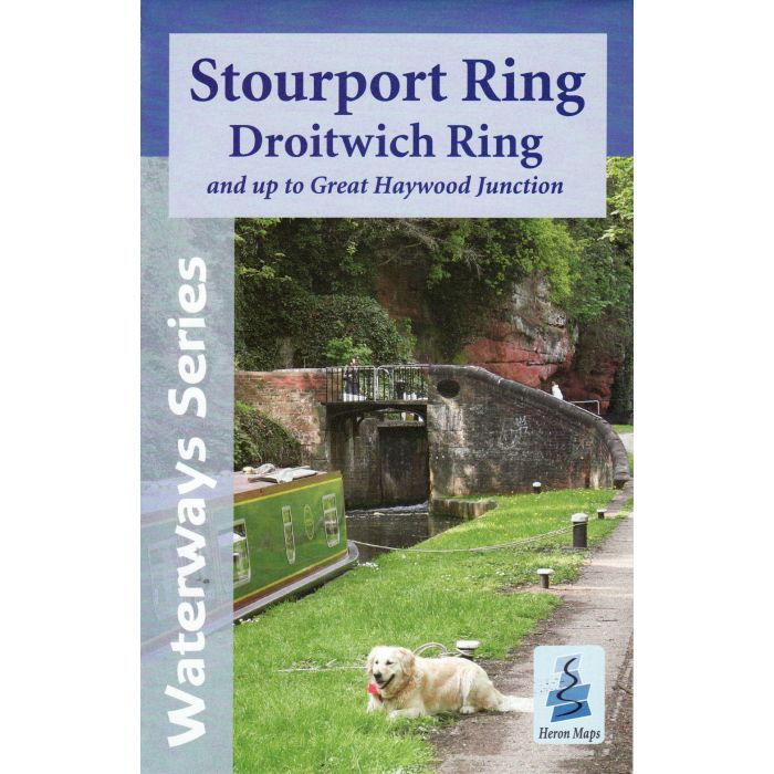
This Laminated map gives detailed coverage of the Stourport and Droitwich Rings including the whole of the Staffordshire and Worcestershire Canal up to Great Haywood Junction where it joins the Trent and Mersey Canal, with emphasis on the waterways and information useful and relevant to users of the waterways without neglecting other leisure users. The map detail is complimented by information panels and photographs.
This Laminated tourist map is at 1:50000 with detailed town plans of Wolverhampton, Tipton, Droitwich Spa, Worcester, Stourport-on-Severn, Kidderminster and Penkridge at 1:12500. An additional plan of the heart of Birmingham at 1:10000 is also included. Click here to see the area covered by this map.
Includes navigation and historical information, visitor moorings, marinas, boatyards and boat hire centres with contact details, facilities for the boat user, sailing and boat clubs, shops, post offices and distance markers. Information for the tourist includes tourist information centres, places of interest, pubs, nature reserves, parks, churches, national cycle routes, long distance paths, public toilets and caravan and camp sites.
-
 Four Counties Ring Pearson Canal CompanionTrent & Mersey, Caldon, Weaver. 9th Ed£11.95
IYW001
New Edition -
 Pearsons Canal Companion Kennet and Avon River ThamesOxford, Reading Brentford£11.95
IYW020
In Stock