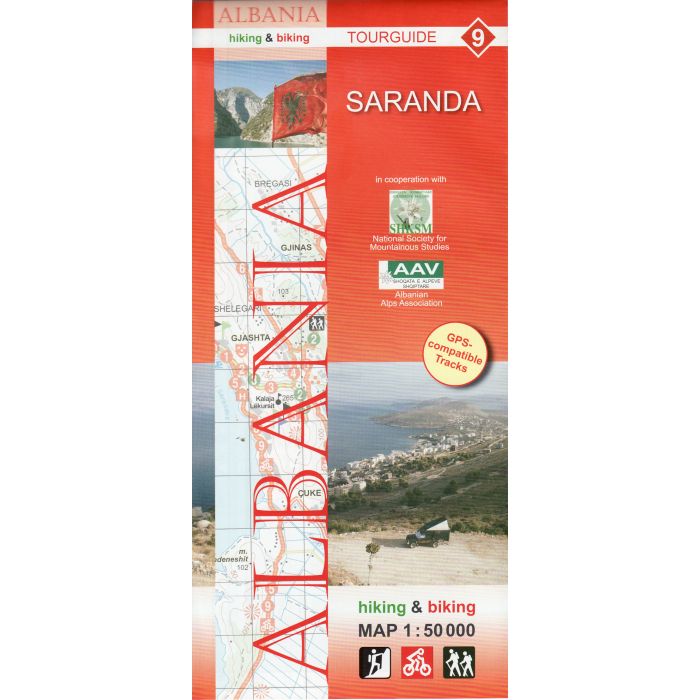
Albania Hiking and Biking Map 9
Saranda 1:50,000
£10.95
In Stock
Usually dispatched within 24 hrs. Free delivery to UK for orders £25 and over
Saranda and environs area of southern Albania at 1:50,000 in a series of GPS compatible contoured maps from Huber Verlag showing hiking and cycling routes, climbing sites, tourist accommodation, etc. Descriptions cover nine cycling routes and four hiking trails.
| Cordee Code: | CMY135 |
|---|---|
| Page Size: | 120 x 265 mm |
| Publisher: | Huber Kartographie & Verlag |
| ISBN13: | 9783943752151 |
| Scale: | 1:50 000 |
| Published Date: | March 2014 |
| Binding: | Sheet Map (folded) |
| Weight: | 80g |
| Product Type: | simple |
| Countries: | Albania |
Saranda and environs area of southern Albania at 1:50,000 in a series of GPS compatible contoured maps from Huber Verlag showing hiking and cycling routes, climbing sites, tourist accommodation, etc. Descriptions cover nine cycling routes and four hiking trails.
Maps in this series, prepared in cooperation with the Albanian Alps Associations and the National Society for Mountainous Studies, have contours at 50m intervals, with spot heights, graphic relief for exposed rocky areas and colouring showing woodlands. Recommended hiking and cycling routes are prominently marked and cross-referenced to descriptions on the reverse side. Interesting towns and villages are highlighted and symbols indicate hotels and other tourist accommodation, sites for climbing and/or kayaking, museums, archaeological remains, medical facilities, etc. The maps have a 1-km UTM grid. On the reverse are detailed descriptions of the recommended hiking and cycling trails accompanied in some titles by route profiles. Map legend and all the text include English.
Maps in this series, prepared in cooperation with the Albanian Alps Associations and the National Society for Mountainous Studies, have contours at 50m intervals, with spot heights, graphic relief for exposed rocky areas and colouring showing woodlands. Recommended hiking and cycling routes are prominently marked and cross-referenced to descriptions on the reverse side. Interesting towns and villages are highlighted and symbols indicate hotels and other tourist accommodation, sites for climbing and/or kayaking, museums, archaeological remains, medical facilities, etc. The maps have a 1-km UTM grid. On the reverse are detailed descriptions of the recommended hiking and cycling trails accompanied in some titles by route profiles. Map legend and all the text include English.
-
-
 Albania Hiking and Biking Map 1Vermoshi, Tamare, Razma, Thethi 1:50,000£10.95
CMY128
Temp Out Of Stock