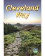
Cleveland Way
A-Z Adventure Atlas Map 1:25,000
£8.95
In Stock
Usually dispatched within 24 hrs. Free delivery to UK for orders £25 and over
| Cordee Code: | CMAZ70 |
|---|---|
| Page Size: | 136 x 240 mm |
| No of Pages: | 52 |
| Publisher: | Geographers A-z |
| ISBN13: | 9781782571964 |
| Scale: | 1:25,000 |
| Published Date: | April 2017 |
| Edition: | 1st: 2017 edition |
| Binding: | Paperback (flapped) |
| Illustrations: | ordnance survey mapping |
| Weight: | 100g |
| Product Type: | simple |

The A-Z Adventure series features the accuracy and quality of the 25k OS Explorer mapping in a convenient book, complete with index.
The A-Z Adventure series is an innovative concept that utilises Ordnance Survey Explorer mapping in a book, therefore eliminating the need to fold and re-fold a large sheet map to the desired area.
Unlike the original OS sheets, this A-Z Adventure Atlas includes a comprehensive index to towns, villages, hamlets and locations, natural features, nature reserves, car parks and youth hostels, making it quick and easy to use. Each index entry has a page reference and a six figure National Grid Reference. At a book size of 240mm x 134mm it is the same size as a standard OS Explorer map when closed.
The Cleveland Way is a 109 mile (175 km) National Trail from Helmsley in the North York Moors National Park, to Saltburn-by-the-Sea, where it joins and then follows the coast to finish in Filey. The trail combines beautiful heather moorland countryside offering panoramic views and a dramatic coastline?with spectacular coastal scenery. There are numerous historical buildings, ancient features, interesting towns and fishing villages to encounter along the way. The route on the map is clearly highlighted in yellow with mileage markers to gauge distances when planning sections of the walk to enjoy.