Around Annapurna Marsyangdi Thorung Pass Kali Gandaki
1:100,000 trekking map
£12.99
Temp Out Of Stock
| Cordee Code: | CMW179 |
|---|---|
| Publisher: | Nepa Publications |
| ISBN13: | 9789937918336 |
| Author: | Nepa Maps 1:100,000 |
| Language: | English |
| Published Date: | April 2019 |
| Edition: | April 2019 |
| Binding: | Sheet Map (folded) |
| Weight: | 60g |
| Product Type: | simple |
| Countries: | Nepal |
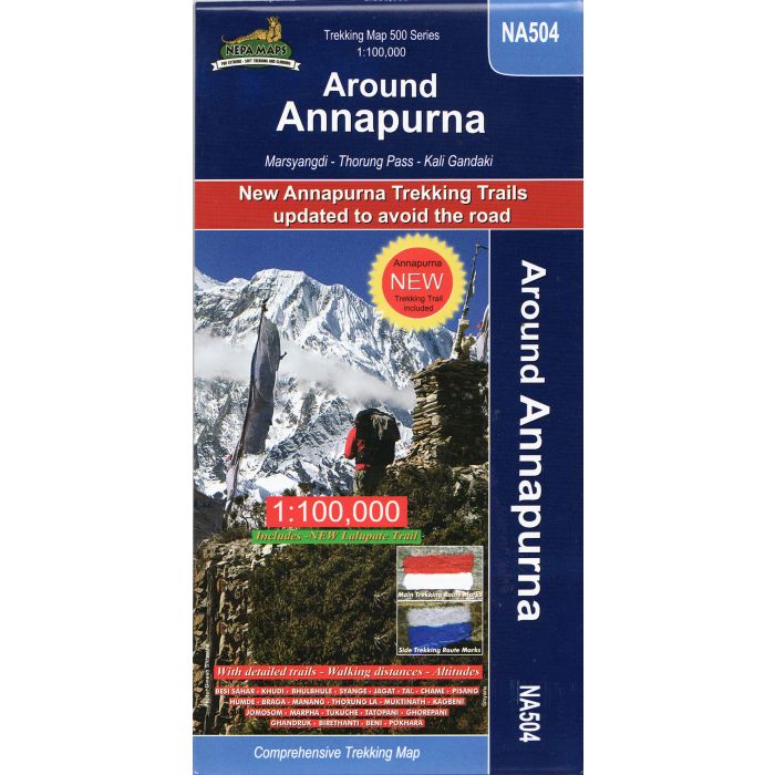
Detailed 1:100,000 scale map of the whole Annapurna circuit, including information on recenlty opened routes. Going from a height of 800m to 5500m this map covers the 9-21 day route. The route goes via Besi Sahar, Chame, Manang, Ledar, Thorung La, Muktinath, Tatopani, Beni, Pokhara.